
We had the pleasure of spending a week out in Whitefish, MT in early July. Some friends got married in Whitefish and we decided to make a long vacation out of it. It was such a great trip! There’s going to be a couple *long* posts dedicated to this trip! I‘m writing a whole post dedicated to staying in Whitefish that will include places we ate, actives, etc, but this is all about us visiting Glacier NP.
We flew out of St. Louis bright and early at 5:30 AM on Monday, July 5th and landed in Kalispell around noon. We were the first from our group of friends to head west that week so we had a couple days to ourselves to get acquainted with the area. We knew we wanted to hike in Glacier National Park on Tuesday, so after grabbing beers & lunch at Backslope Brewery in Columbia Falls, we headed to Whitefish to check into our hotel and do a grocery store run to pick up some food supplies for hiking. We ended our night with some Tex-Mex and a rooftop sunset.
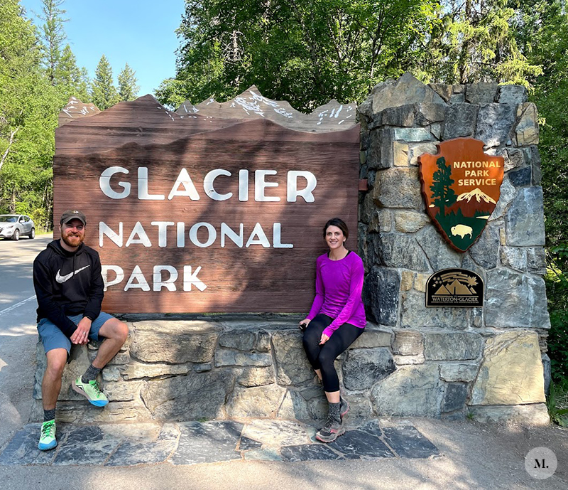
Visiting Glacier National Park
To start, make sure you’re prepared with all of the required documents. The park has changed things up in order to enter. We entered the park before 6AM every time, so we could have gone without the two items below.
REQUIREMENTS FOR ENTERING THE PARK AFTER 6AM
From 6AM to 5PM, you have to have a couple documents to enter GNP:
1. Your Going to the Sun Road reservation ticket ($2.00)
2. Park Pass ($35-80 depending on the type you select) We opted for a full annual America the Beautiful National Park Pass (this pass allows us to access any national park in the US)
Really helpful site that breaks it down here!
If you don’t have one or either of those items, it’s best to get past the guard gates before 6AM or after 5PM. Because of this there, are SO many people who enter the park outside “normal” hours. Camping, bike excursions and tours have exceptions or additional requirements, so it’s best to check.
Other General Tips:
You will NOT get cell service inside of the park. Make sure you have maps, directions, etc downloaded to your phone before entering the park. Google Maps GPS works a bit when you don’t have service, but it’s still good to know your whereabouts.
Dress in layers! We were there when they were still experiencing some high temps, but at the top of the mountains and the GTTS road it was cold! In the mornings before the sun was up it was only 55 degrees at the top. I kept my long sleeves on for all of our morning hikes and I even wish I had another layer at times.
Bear spray! We saw lots of other wildlife, but never a bear. However several of the trails had been posted for bear activity while we were out there. You can’t fly with the stuff (not even in a checked bag) so a lot of people leave it at their hotel to be passed on or rent from the airport. Our hotel provided it to us for free.
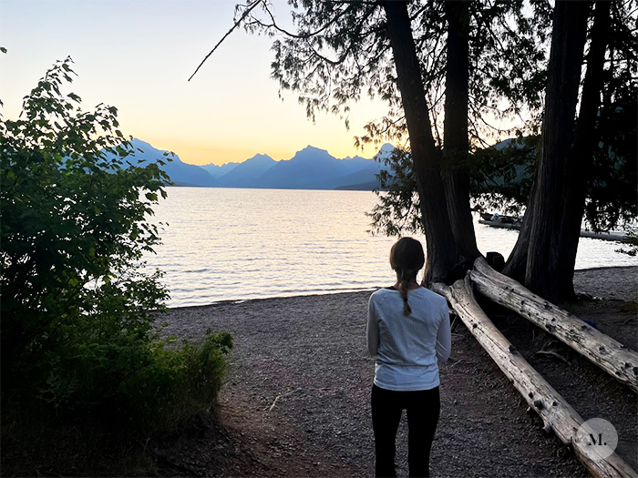
Sunrise at Lake McDonald at Apgar Village
We started our first morning in the park by stopping in the Apgar Village area to watch a bit of sunrise over Lake McDonald. We pulled into the very small parking lot right at 5:30AM and stayed for about a half hour. It was chilly, but beautiful. The sun never peaked over the mountains while we were there, but after seeing SO many cars heading up the road we felt like we needed to continue on up the Going to the Sun Road. Which, I’m glad we did.
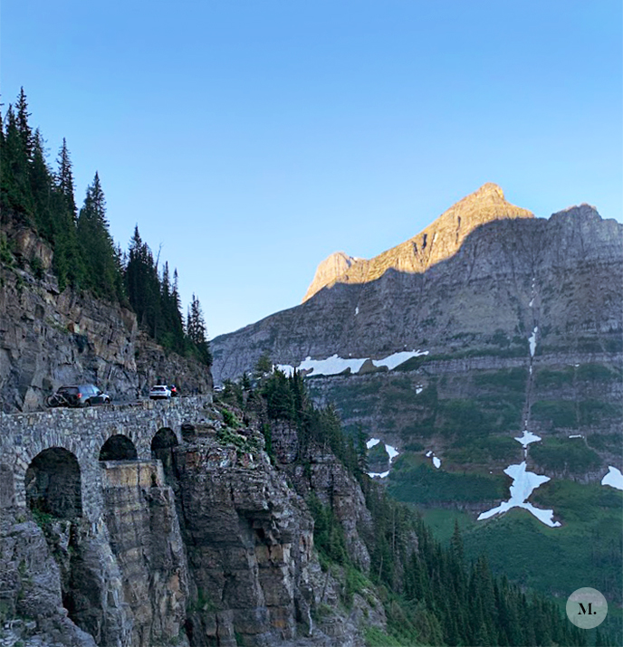
Going to the Sun Road
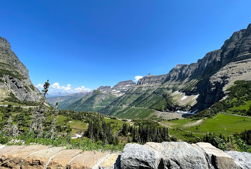
The GTTS road is about 50 miles long and takes roughly 2 hours to drive between the west and east entrances after entering the park. This is the only road that goes through the park. The views just keep getting better as you drive further into the park. After entering the west side, a large chunk of time is spent driving past Lake McDonald. There’s several camping sites, trails and spots to hop off the road for lake viewing.
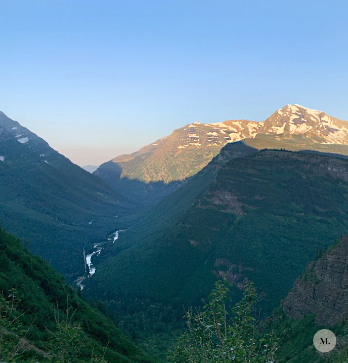
Once you start climbing, you climb pretty fast. You go from a tree lined road to winding along cliff walls and open views of the park. The guardrail goes between a low rock ledge and wood logs. You can only drive about 15 mph once you start climbing. Talking about and showing pictures does not even come close to how amazing the views are. Our goal for our first day in the park was to get to the Logan’s Pass visitors center (halfway through the GTTS Road) and go out on a couple hikes from there.
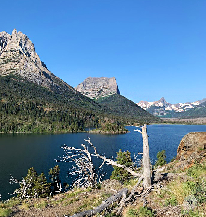
We had read and been told that if you aren’t to the visitors center by 7AM then you most likely won’t find a parking spot. From our hotel in Whitefish to the visitor’s center parking lot, it was a 1.5 hr drive. We wanted a spot, so we planned to arrive at 7AM after watching a bit of the sunrise over Lake McDonald. Well when we arrived right at 7AM, the lot was full and cars were circling. We also circled for ~35 minutes before we decided to leave and find another spot in the park to explore. We were both feeling a bit frustrated because we hadn’t really planned much else for that day. Fail on our part. We headed east towards St. Mary’s and found ample parking in the Sun Point parking lot around 8AM.
It’s MUCH quieter on the east side of the park. There are several longer hikes that start from the east side of the park that I’ve read are pretty amazing. If ever we make it back, I’d like to explore more of that area.
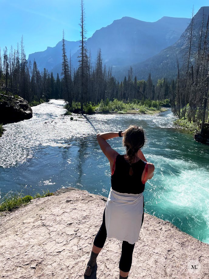
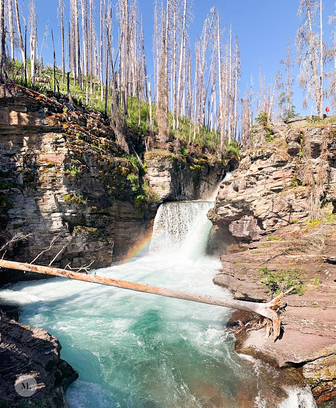
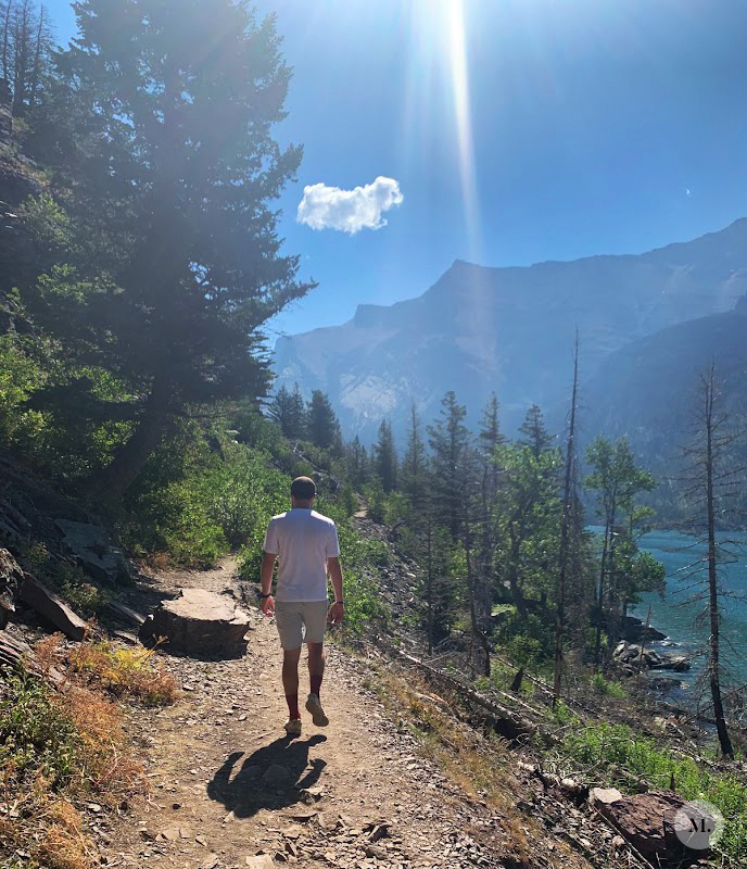
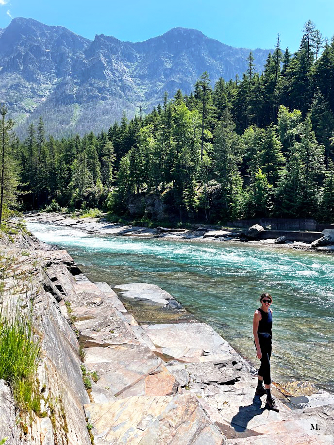
Hiking Sun Point to St. Mary’s Falls
I admittedly hadn’t researched much about East Glacier. I had noted a couple hikes to maybe check out but had not made any concrete plans around them. I knew about the existence of Sun Point, but that was about it. We arrived at the Sun Point parking lot around 8AM and it was practically empty. Once you hop on the trail from the parking lot, if you go left (east) then you get to the point – a big open rocky lookout point. Head to the right (west) to hike on to St. Mary’s. We ended up really enjoying this hike. There were some minor climbs but overall it was an easy hike. We call it our happy accident for that day.
Our Hike’s Stats
– Parked Here
– Trail description
– 5.85 Miles (This includes walking around on Sun Point, so what we recorded is a bit longer than if you kept to the trail. We turned around at the big water feature shortly past St. Mary’s Falls)
– Out and back
– 2 hrs with minimal stopping
– Less than 700 ft of elevation gain
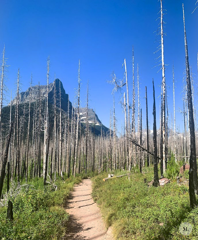
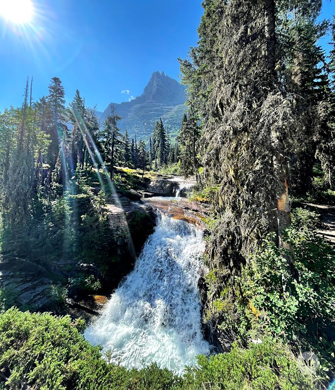
There was a wildfire through part of this area back in 2015, so the trail winds through burnt tree trunks – it was actually pretty neat to see. This also means that there was minimal shade for almost the entire hike. The up side of this is that you got views of St. Mary’s Lake for a large portion of the hike, which wouldn’t have been possible if the trees were in a non-burnt state. We saw a few waterfalls along this hike and they were flowing! There was still snow at high elevations and the area just experienced record heat the week before so the snow melt was abundant. We thought about heading all the way to Virginia Falls but decided to head back, eat some lunch and check out other area of the park. There weren’t too many people on our way out, but the trail got pretty busy as we got closer to returning to Sun Point.
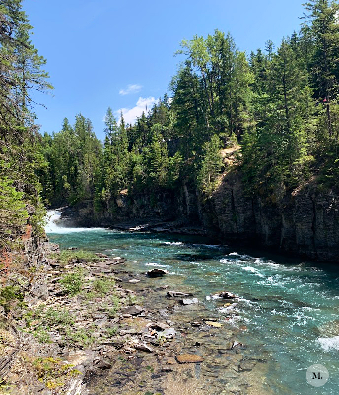
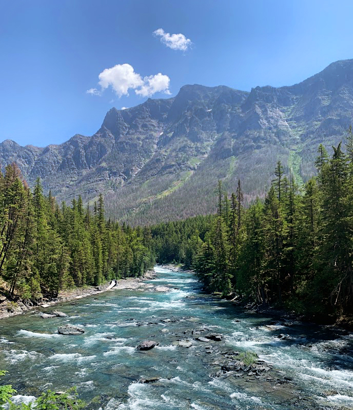
Lower McDonald’s Falls
This was another trail that we kind of stumbled upon on our way out of the park. I saw the sign for the trail head and decided to check out. The full trail is ~5.5 miles, but we only did the first mile before heading back. To be honest, we were exhausted from traveling the day before and getting up at 3:30 AM again that morning so we were okay with something low key. It was super easy and BEAUTIFUL – almost more of a nature walk vs a hike for that mile we did. You get water views almost the whole time with plenty of gushing water and falls. Horses also use parts of this trail, so be on the lookout for them if you ever do this trail. This was actually the first of two times we did this section of trail and there really weren’t many people. On the way out we only saw a handful, but on the way back to the car it had gotten busier.
Our Hike’s Stats
– Parked Here for the McDonald Creek Trail
– 2 Miles RT (We turned around at the footbridge that crosses the creek 1 mile in )
– Out and back
– 45 minutes with stopping to take photos at several points
– Less than 200 ft of elevation gain
We ended our day by swinging into Kalispell to meet a couple friends who had just landed in town. We got a couple rounds of beers at Kalispell Brewing Company and then headed back to Whitefish for the evening.
Pt 2 with a few more hikes are next!
A full breakdown of what we did and where we ate/drank in Whitefish after that!
—m.