
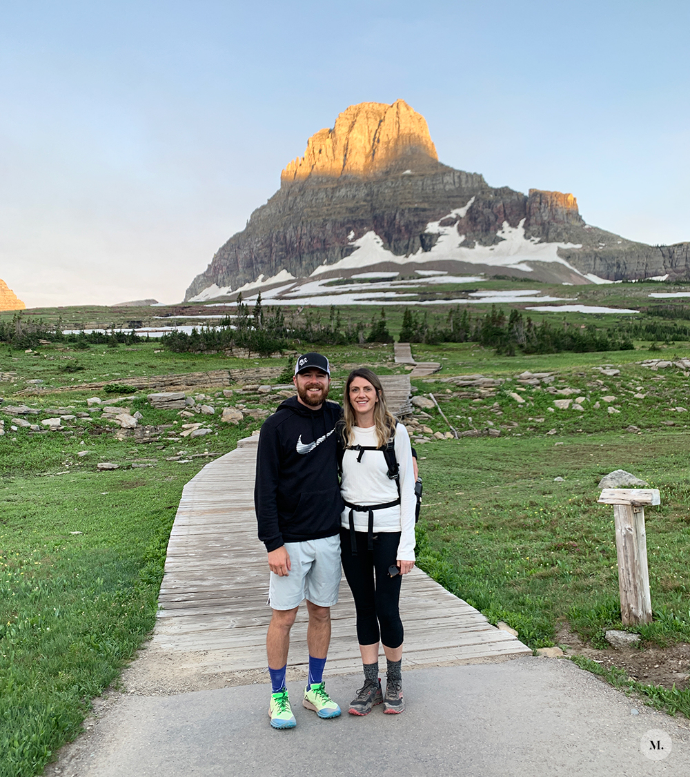
We headed back into Glacier NP on our second full day in Montana with our friends that arrived the day before (the bride and groom!). We learned from our first day that we needed to arrive to the visitor’s center BEFORE 7:00 am if we wanted a parking spot. So for our third day in a row, we woke up very early and headed out on our 1.5 hr drive. We arrived to the Logan Pass visitor’s center just after 6AM with half of the parking lot open. Woo!
Hidden Lake Trail Hike
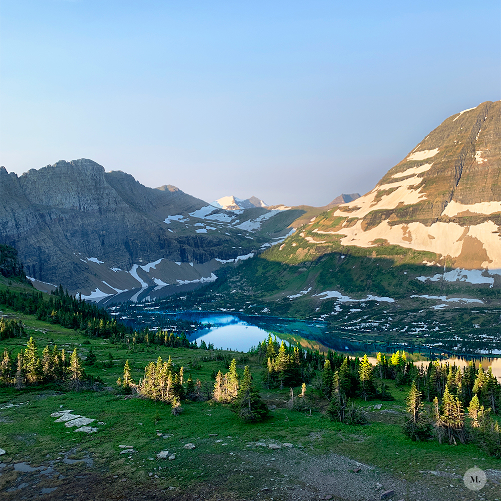
This was the only planned hike for this day. The park was not allowing visitor to go past the lookout due to bear activity down at the lake, so the trek was only about 3 miles RT vs 6 miles. That made me a little bummed, but it was still great. Because we arrived at the visitor’s center early and headed out almost right away there were only a couple people ahead of us on the trail. However, on the way back there were SO MANY people heading out. It’s one of the most (if not the most) popular trail due to it starting at the visitor’s center. It honestly looked miserable to be on the trail with THAT many people. There were only three other people at the turn around point with us, which was so nice because the lookout isn’t very big.
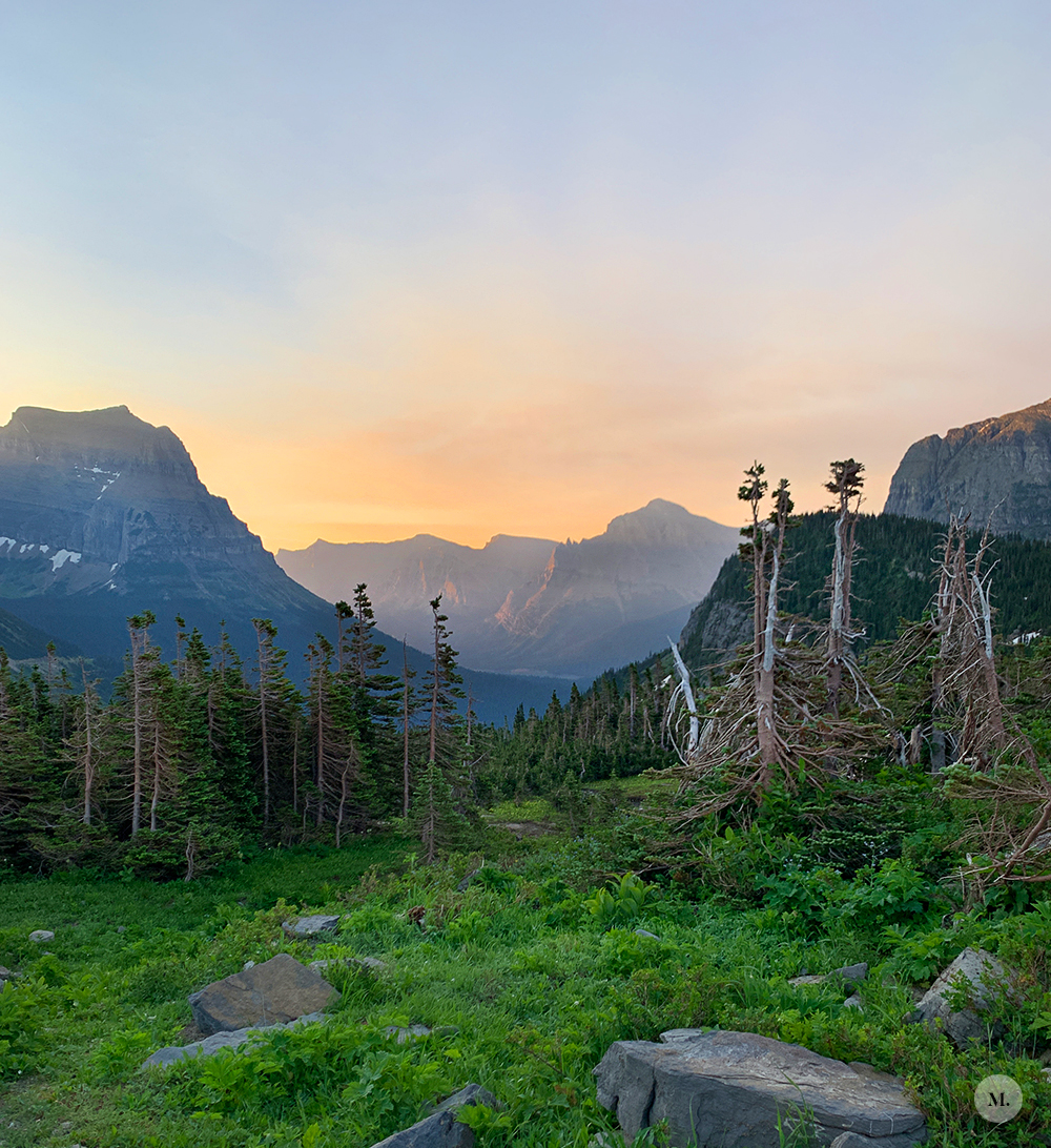
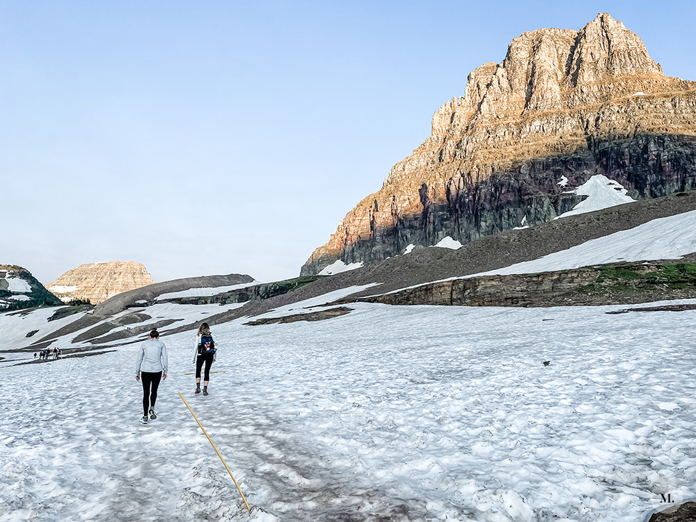
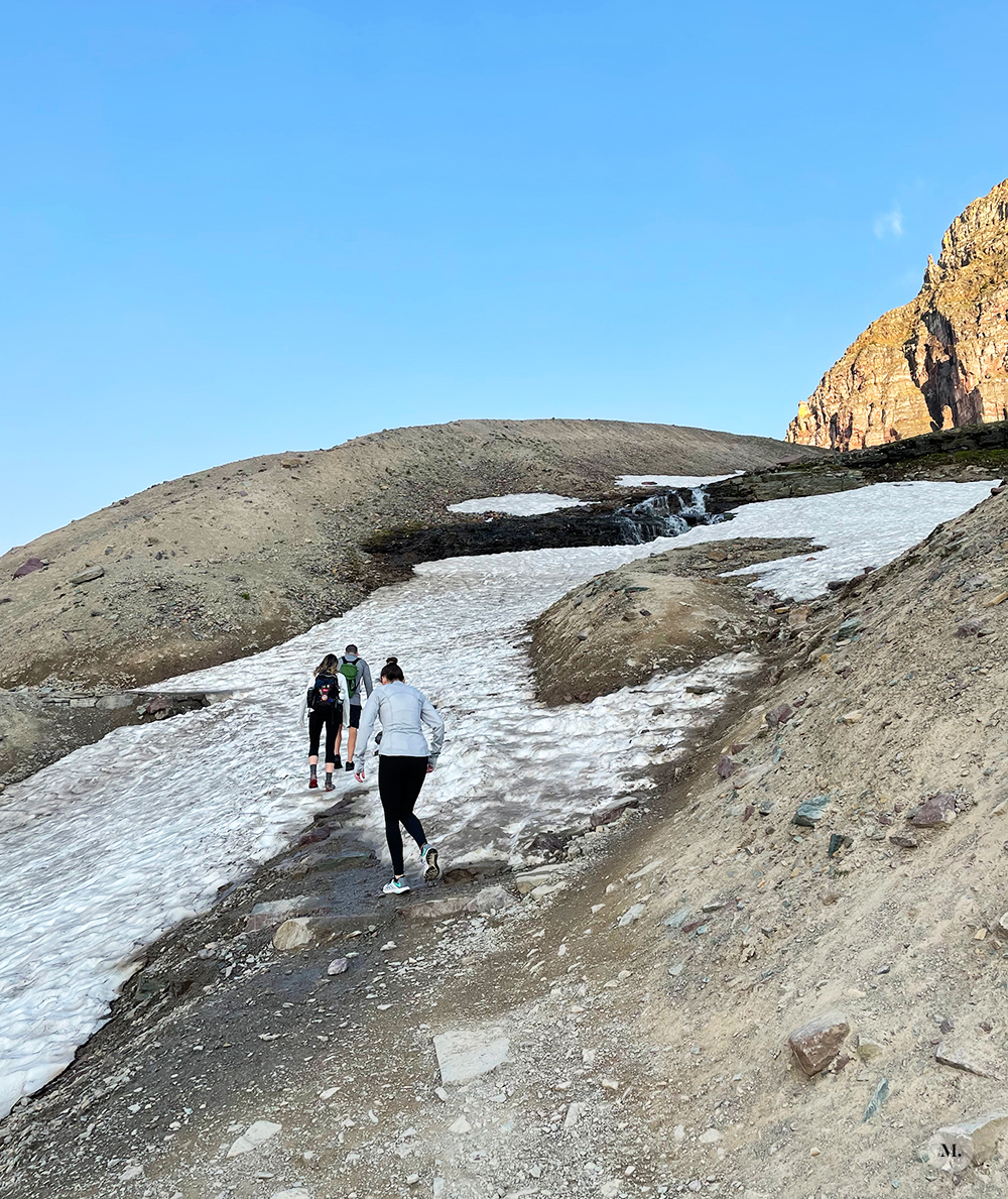
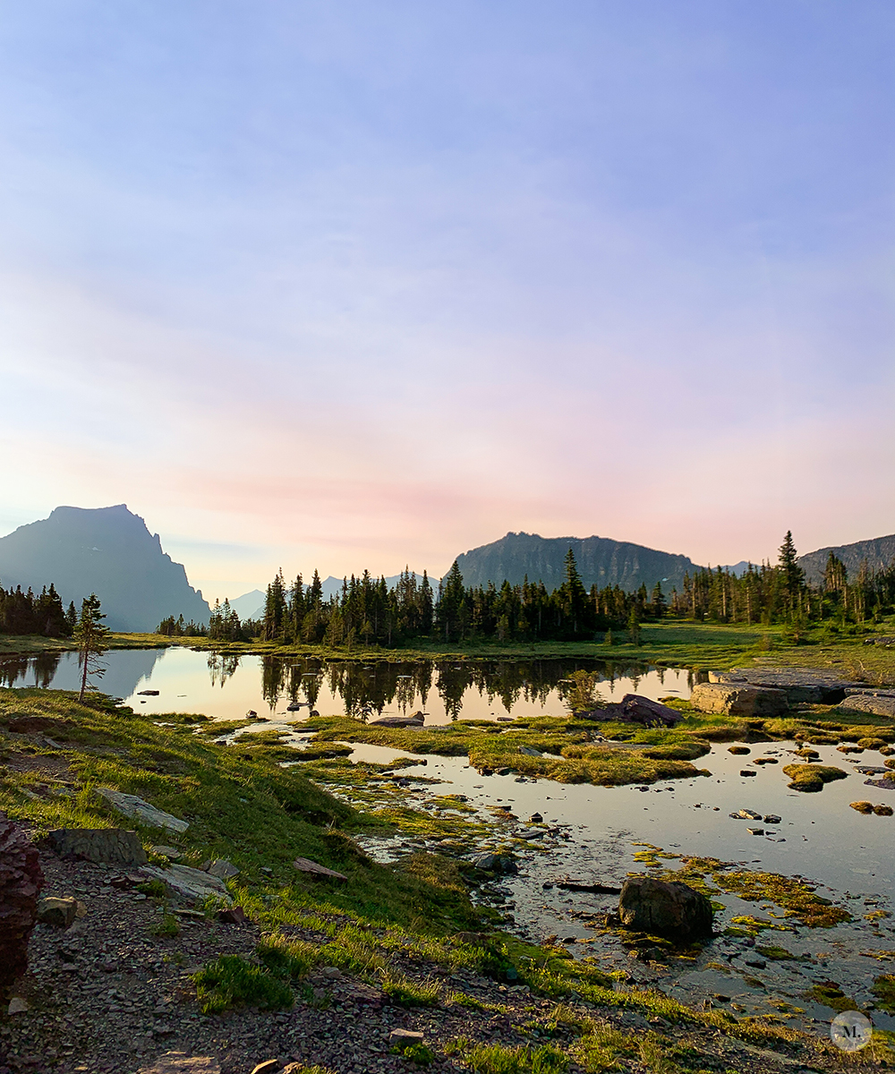
Another plus side to starting that early (in addition to not really having anyone around us when we headed out) was that we were able to watch the sun rise over the mountain peaks and just truly enjoy the trek. It was BEAUTIFUL watching the sun rise and the changing colors of the sky. We really lucked out with conditions that morning. It was cold, but still such a nice morning. The interesting (and semi-funny) part of the hike was the giant snow field we had to practically crawl over. Even though it was early July and the region had just experience record heat the week before, there was still plenty of snow at that elevation. The snow was slick on top so there was a lot of slipping and catching your balance and some tricky uphill climbs. I was very thankful to have trail shoes and not slick tennis shoes. This is a good example of checking trail conditions and talking to rangers before heading out because there was a large amount of people who were not prepared and actually did not go past the boardwalk. Had there been no snow, the hike to the lookout would be considered easy IMO. The first half mile of the hike starts on a boardwalk and climbing stairs.
Our Hike’s Stats
- Just under 3 miles
- Out and back
- Just over 1 hour with some stopping for photos and hanging at the lookout for a short bit
- Just over 500 ft of elevation gain
High Line Trail (kind of)
I wanted to do this full hike SO bad, but I couldn’t convince Tim to hike the 15 miles so I wrote it off. Spoiler alert: we did not do the full 15 miles but we did go 1 mile out on the trail and turned around to head back to the car. Basically to check out the insane wall portion and see some views.
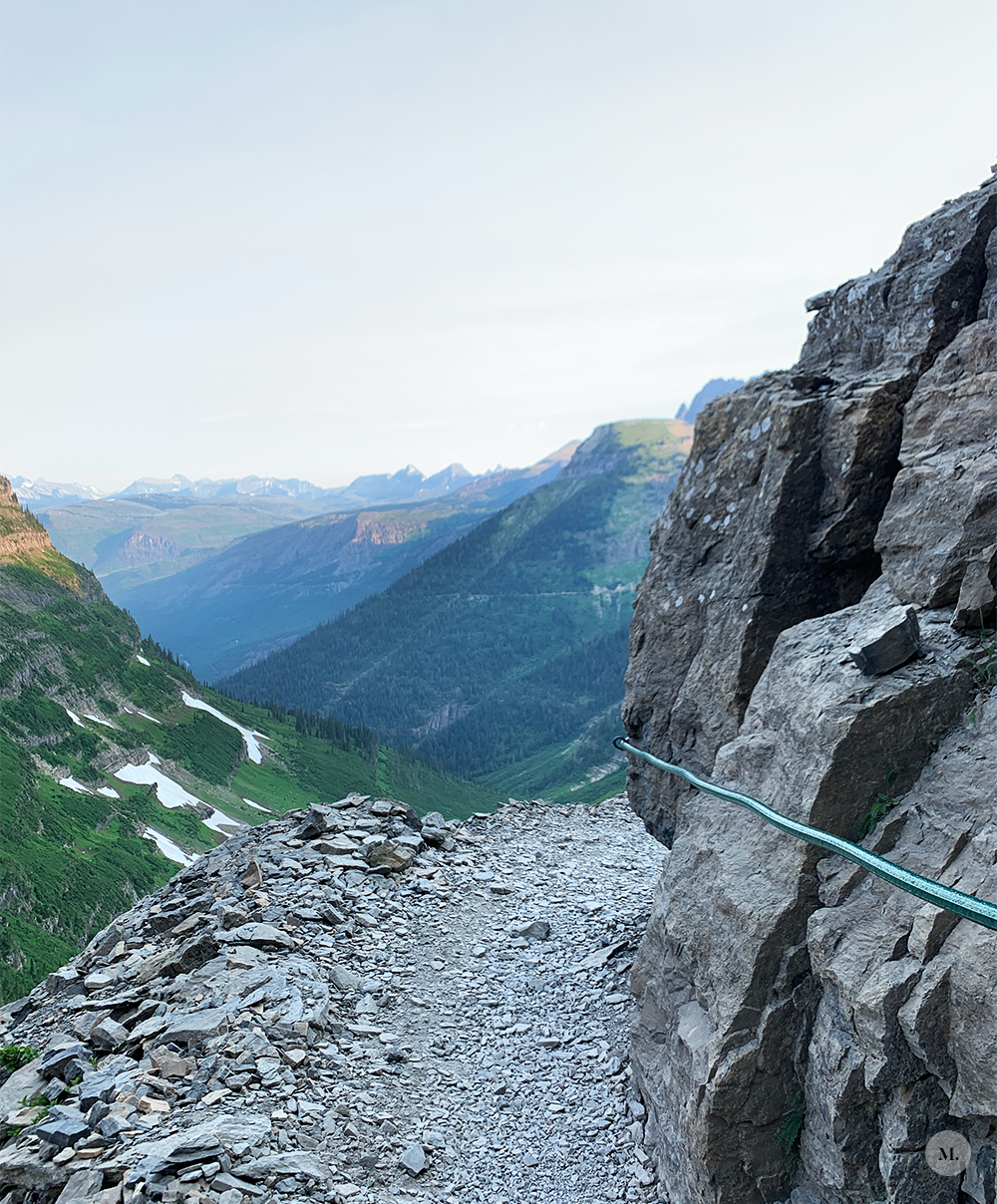
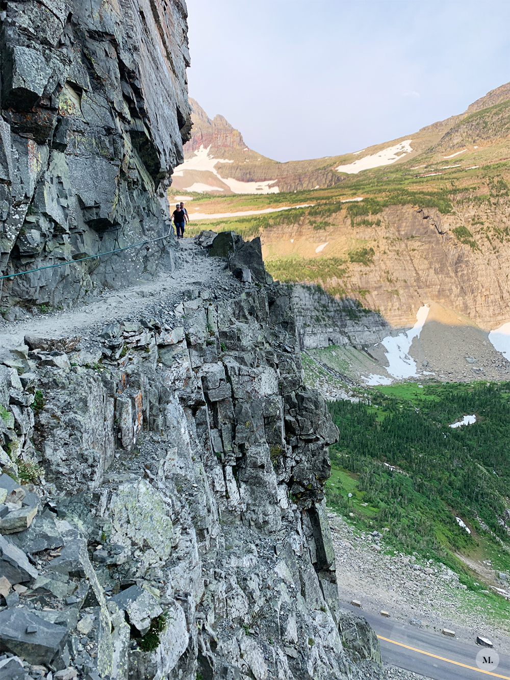
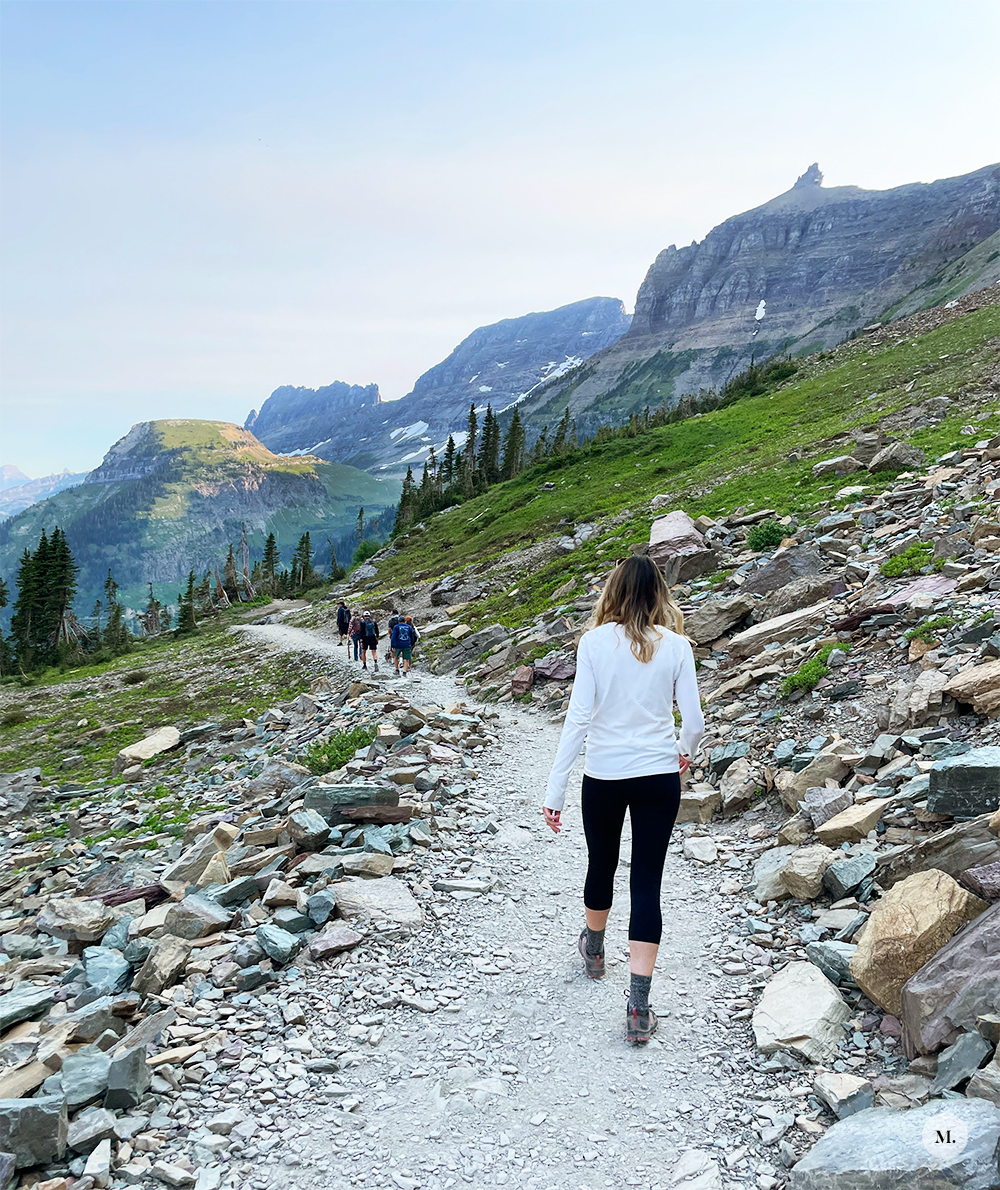
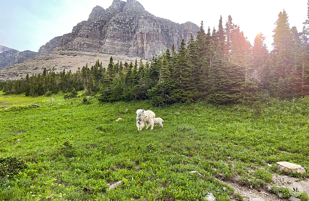
But first a (semi) funny story: I had marked on a map that – distance wise – starting at the visitor’s center and hiking north to Haystack Butte and back would be a very doable hike and I had read that that area of the trail often results in seeing mountains goats. I saw it was on the High Line Trail and that part wasn’t difficult. Great! Well, it wasn’t until we were arriving to the visitor’s center that morning that it clicked that the first part of the High Line Trail included crossing the scary looking granite wall. Tim was not having it because he doesn’t do heights. I literally do not know how, but we convinced him to go out on the trail and conquer the wall. Which also meant he had to the wall portion twice. He didn’t look at the views once and needed a couple breaks during that 2 mile trek, but he did it. I’m really proud of him.
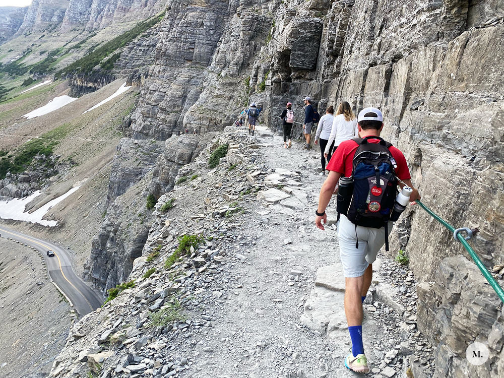
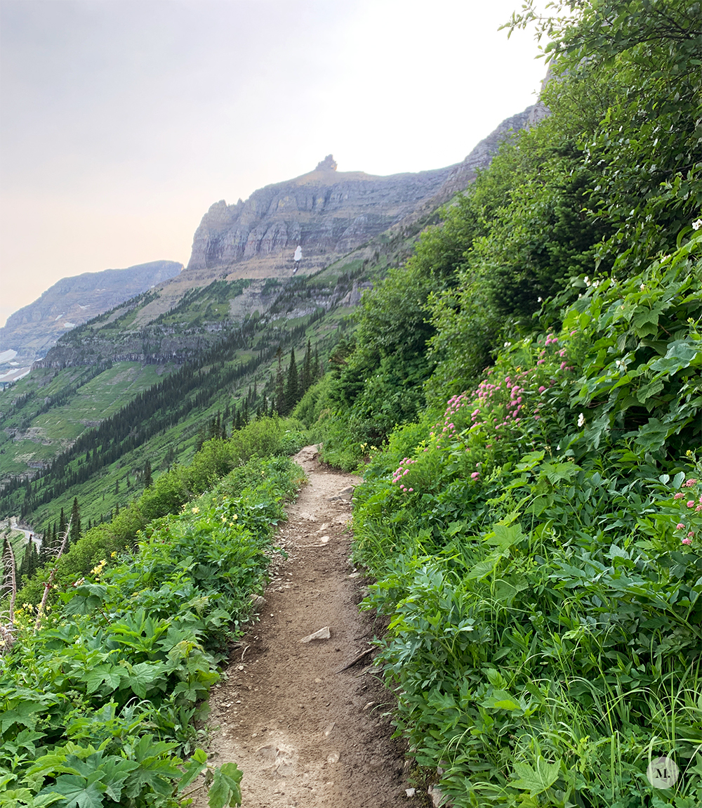
The part of the trail along the granite wall is not for the faint of heart. It is a bit scary. I was so in awe and did think it was awesome, but it was a bit terrifying when you had to share the narrow path with people heading in the opposite direction. North past the wall, there is still a steeper grade down to your left, but not a complete drop off. And lots of vegetation. I still would have loved to do this whole hike, but I was happy to get to do the 2 miles we did do. And yes, we did see some mountain goats on the trail and big horn sheep by the visitors center!
John’s Lake Loop
The four of us were interested in doing the Avalanche Trail but parking was full and after circling a couple times we decided to head up the road and park back where we had the day before for the Lower McDonald Falls trail. We head back out on the same trail we had done the day before but also continued on to do the full John’s Lake Loop. This hike was more of a nature walk and was very easy. We stopped at the foot bridge 1 mile in to eat an early lunch before continuing on. The vegetation was very different being at a lower altitude than higher up in the mountains – very forest-y with dirt vs rock paths. I actually didn’t really take photos on this hike because there aren’t any views – just walking through a bunch of trees
Our Hike’s Stats
- ~2 miles
- Loop
- 45 minutes
- Just under 200 ft of elevation gain
This hike was probably my least favorite that we did. I think it’s fine if you’re looking for more of an easy nature walk or have younger kids in tow. After this hike we headed back to Whitefish!
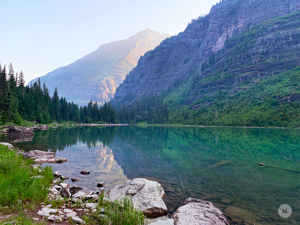
Avalanche Lake Trail
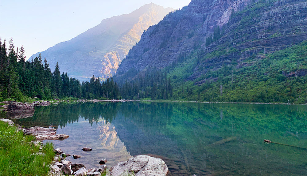
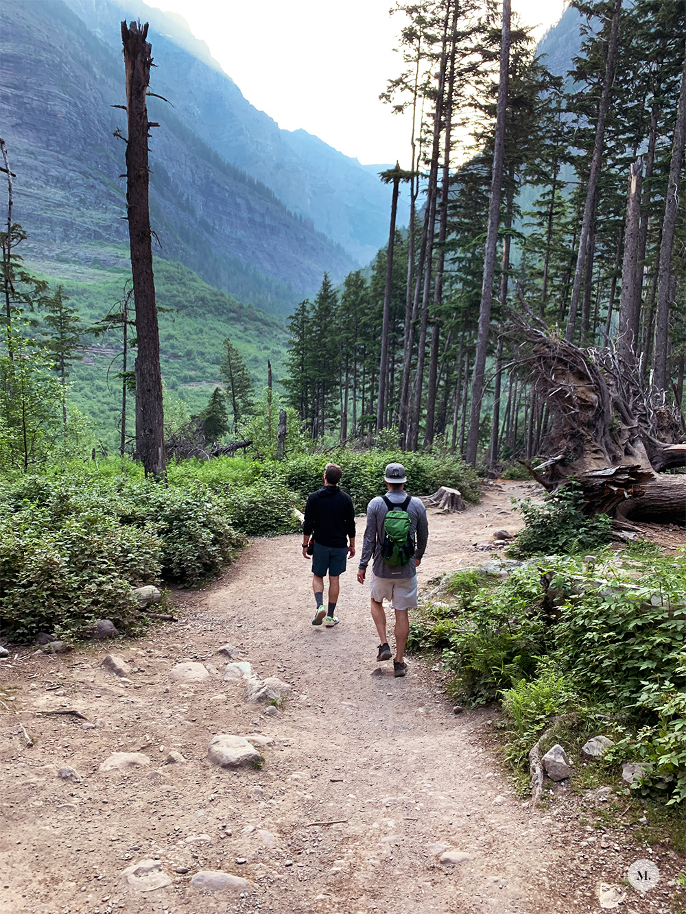
We decided to squeeze in one more hike on our last day before having to head to the airport. We had yet another early morning in order to find a parking spot. After seeing how full the parking lot was our first two times in the park, we knew we would need to arrive to the Avalanche parking area by 6:30 AM. Apparently a lot of people got that memo because this hike was one of the busiest we did while there.
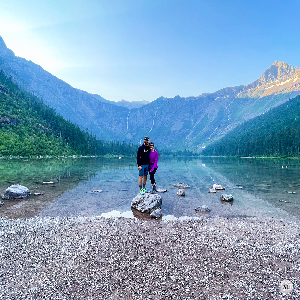
We started with going though the Trail of Cedars, which is a walk through a mossy, forest type of area on a boardwalk. It’s the only ADA trail in the entire park and is also great for people with young kids. The Trail of Cedars area was really pretty. Once on the avalanche trail, the trail is dirt and there is some climbing but nothing technical. The views once you reach the lake were beautiful! The sun starting to hit the top of the peaks at the opposite end of the lake so there was still a bit of that morning haze, but it was still so pretty.
Our Hike’s Stats
- Parked Here
- 7 miles (normally 4 miles RT)
- Out and back
- 2 hrs, 40 minutes
- ~850 ft of elevation gain
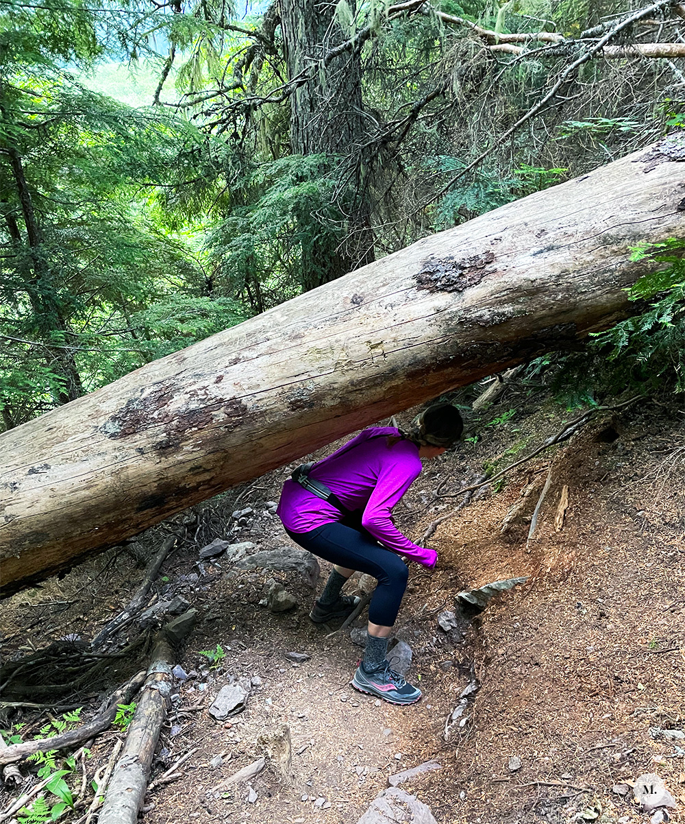
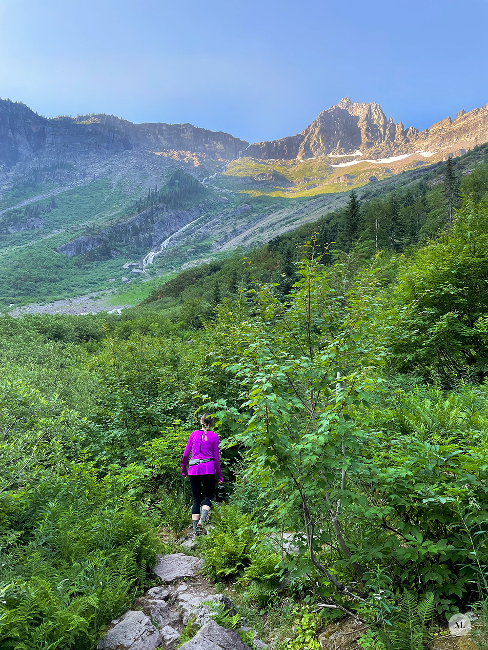
The fun part started when decided to continue on past the end of the trail… (sshhhh!) Once you get to the sign that reads “End of Trail” at the far end of the lake, you’ll notice that the footpath continues. It starts as pretty well marked/traveled, but does soon get more rocky and walking through the brush. That part of the trail DID get technical. There was climbing over and under fallen trees, very rocky footing, lots of vegetation around the feet. We wanted to see a waterfall close up! Which we technically did, but it wasn’t quite what we were expecting. The trail we ended up on stopped when we hit the flowing water/stream so we had to turn around and make the trek back. There IS a way to get to a beach area at that far end of the lake, but we did not go searching on how to get there. The hike overall did not disappoint and it was a great way to end our trip.
So that’s all the hikes we did *inside* of GNP. (Did a couple more around the Whitefish area.) I loved our time inside GNP. It has been a bucket list destination of mine and I already want to go back and explore the other areas.
—m.